Farming in Cumbria
Cumbria is the third largest county in England by area, thanks to 20th century changes to county boundaries which amalgamated the old counties of Cumberland and Westmorland with parts of north Lancashire and north Yorkshire.
It is bordered to the north-east by Northumberland,
to the east by County Durham,
to the south-east by North Yorkshire,
to the south by Lancashire, to the west by the Irish Sea,
to the north-west by Dumfries and Galloway,
and to the north by the Scottish Borders.
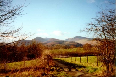
Cumbria is predominantly rural and contains the Lake District National Park, a UNESCO World Heritage Site. The LDNP has now joined up with the Yorkshire Dales, with the intermediate area designated the "Westmorland Dales".
Visitors tend to think of the Lake District as a wet and chilly place, particularly if they come in the school summer holiday. The best months are often May and October, with the bonus of wonderful autumn colour in the trees and the fells.
However, the farmers say that in the Lakes there are "nine months of winter, and three of bad weather!"
Climate
The counties of Cumberland and Westmorland, as Cumbria used to be known, have a wide variety of climate: there is the dryer area of the Eden Valley in the east, the early growing Solway plain to the north, the wet valleys or "dales" around the harsh central mountain hub, and the milder coastal areas. There is also the Gulf-stream-warmed Furness peninsula to the south which Lancastrians still think of as part of "their" county.
Summers are cool and wet, and winters are windy and wet! They have not been as frosty or snowy as they were in the past. In the 1990s the snowfall was less than it was in the 1980s and despite short-lived heavy snowfalls such as the "Beast from the East" in 2018, there has been no winter to rival 1963 or 1947.
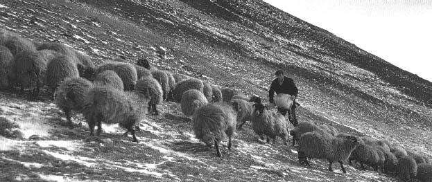
Robbie Hudson feeding Swaledale sheep on the fell, 1969/70
Rain!
2000 was notable for its heavy and persistent rainfall, and in 2001 Cumbria suffered a late spring and, sadly, Foot and Mouth disease. Summer 2002 was also extremely wet but made up for it with a fine dry warm September.
There have been localised floods in Cumbria for centuries; Borrowdale, for instance, was badly flooded in the 1960s. More recently the 2005 flooding of Carlisle and the 2009 flooding of Cockermouth have made people uneasily aware that the climate seems to be changing, and flood action plans are being put in place, plus projects to slow the flow of water off the higher land.
Fell Rights
Many hill farms have "fell rights" on which to pasture sheep, cattle and occasionally ponies. This use goes back centuries, to well before the Enclosures Act. Andrew Pringle describes the use of the "common" land of Westmorland in 1794:
"No person shall send to graze on any common more flock than he can winter upon his estate or farm, in right of which he has a title to pasturage on that common ... the commons are almost always overstocked to such an extent that many persons do not think it worthwhile to avail themselves of their right of commonage."
A brief summary of how fell rights developed and how they regulate grazing - particularly for ponies - can be found on the Fell Pony Society's web site in their 2019 Autumn Magazine (p79 onward).
The Commoners' Associations (2008) reported fewer farms using the common fell land, resulting in fewer people available to maintain the flocks turned out on the extensive grazing. "Gathering" stock off the fell land is difficult without plenty of manpower.